

© Bratislava Region Tourism
Tourdaten
88,57km
133
- 158m
104hm
124hm
05:55h
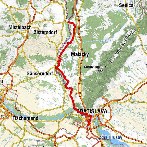

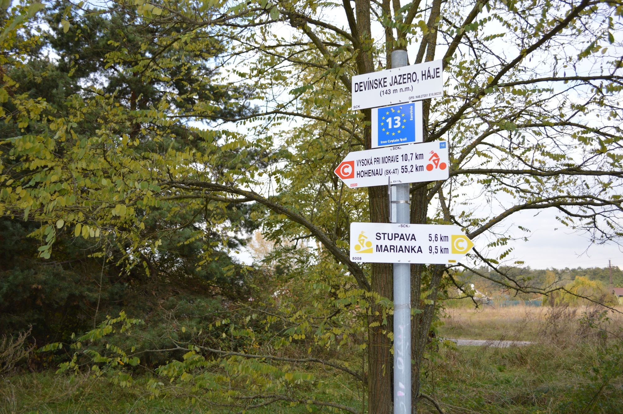
Eurovelo 13 SK-AT
- Kurzbeschreibung
-
Eurovelo is a network of 14 long distance cyclo-touristic routes covering all Europe. Currently, 45 thousand kilometres of these routes are in operation and the completion of the whole system is planned to be realized by the year 2020 when the overall network length of EuroVelo will have reached 70 thousand kilometres.
- Wegverlauf
-
Medzi včelínmi3,7 kmVeselé20,6 kmKlčované lúky21,3 kmDimburg29,8 kmKostol Krista Kráľa30,0 kmKostol sv. Michala archanjela33,5 kmUngeraiden33,5 kmKostol sv. Ondreja apoštola42,0 kmHochstetten42,2 kmStarý Salaš46,4 kmMarchegg48,1 kmMalé diely54,0 kmTheben-Neudorf60,9 kmAbrázna jaskyňa60,9 kmPri Rochu61,9 kmPri širokej celine62,4 kmDevínsky hradný vrch (212 m)64,7 kmTheben65,2 kmGronáre66,8 kmAnjelské záhrady67,9 kmSyráreň69,2 kmZlaté schody69,7 kmKarlsdorf70,5 kmŠvédske domky73,0 kmAltstadt76,6 kmRosenheim76,7 kmBratislava77,1 kmDvory VI78,1 kmDvory V78,4 kmMatadorka78,9 kmVojenský dvor84,4 kmPizza Carla84,4 kmEngerau85,0 kmAltstadt85,3 km
- Beste Jahreszeit
-
JanFebMärAprMaiJunJulAugSepOktNovDez
- Höchster Punkt
- 158 m
- Höhenprofil
-

-

-
AutorEurovelo 13 SK-ATDie Tour Eurovelo 13 SK-AT wird von outdooractive.com bereitgestellt.
GPS Downloads


Allgemeine Infos
Einkehrmöglichkeit
Kulturell/Historisch
Flora
Fauna
Aussichtsreich
Weitere Touren in den Regionen