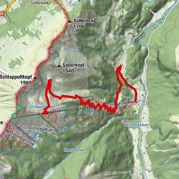
Station Schlappoldsee - Alpe Schlappold - Fellhornbahn Talstation

Wanderung

Tourdaten
7,82km
918
- 1.757m
4hm
00:45h
- Schwierigkeit
-
mittel
- Bewertung
-
- Ausgangspunkt
-
Fellhorn Station Schlappoldsee
- Wegverlauf
-
Fellhornbahn 20,0 kmGasthof Laiter5,9 kmRingang6,5 km
- Beste Jahreszeit
-
JanFebMärAprMaiJunJulAugSepOktNovDez
- Beschreibung
-
Station Schlappoldsee - Alpe Schlappold - Fellhornbahn Talstation
Kies / Asphalt
ca. - 860 Hm
- Höchster Punkt
- 1.757 m
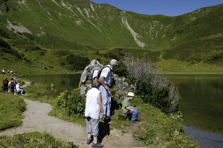
- Rast/Einkehr
-
Bergrestaurant Schlappoldsee
- Anreise
-
Mit der Fellhornbahn
GPS Downloads


Wegbeschaffenheit
Asphalt
Schotter
Wiese
Wald
Fels
Ausgesetzt
Weitere Touren in den Regionen


